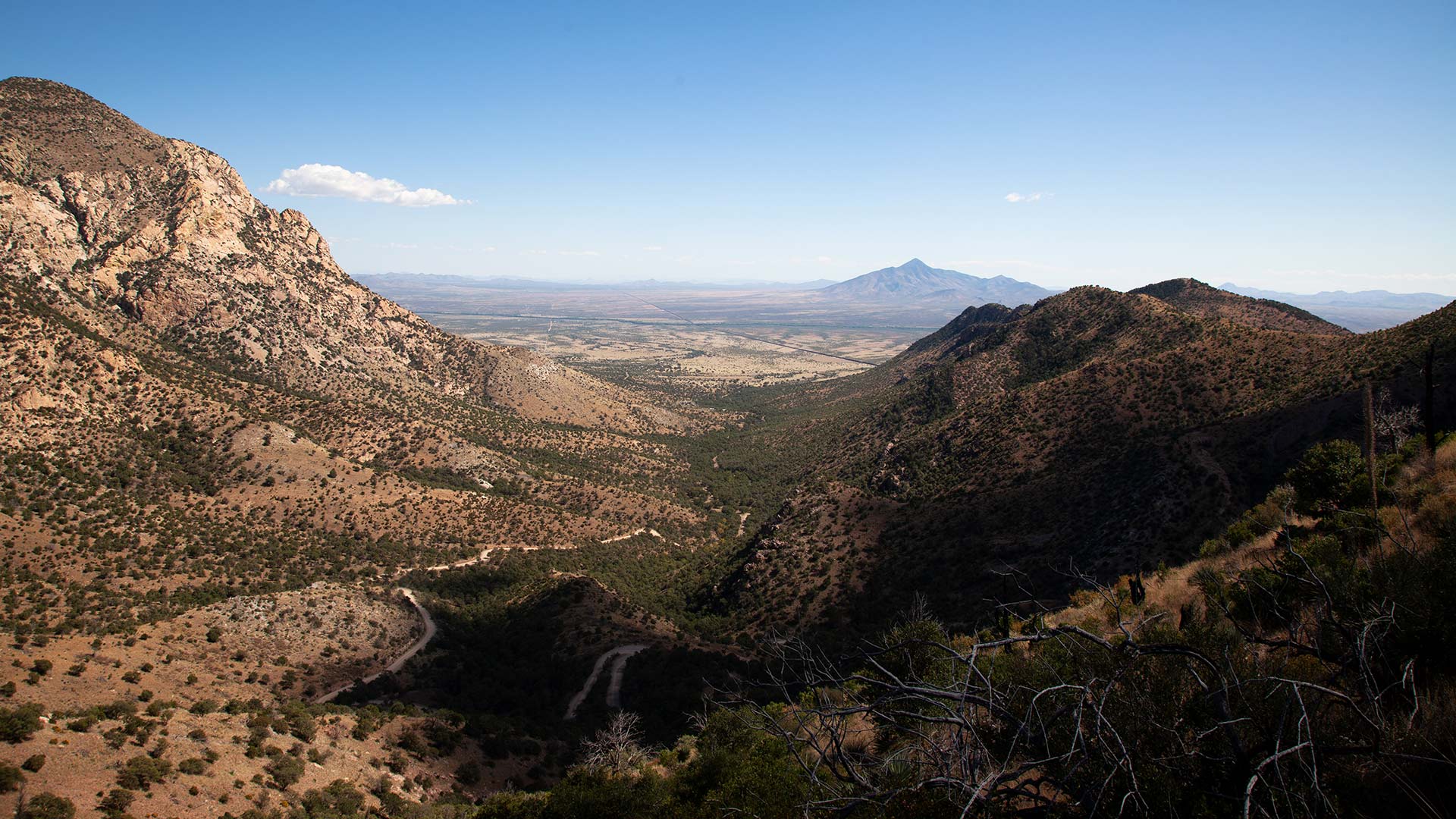
 View of the San Pedro Valley from Montezuma Pass in Coronado National Memorial, on Wednesday, Oct. 18.
Looking down from the summit of Montezuma Pass, are moving views of rolling grasslands and oak woodlands, fairy duster shrubs and agaves and inconspicuous wildlife that's mostly hidden to the naked eye.
To the west lies the San Raphael Valley, while the east showcases the San Pedro Valley, providing a glimpse of an endless border wall that separates Mexico and Arizona. This landscape is part of the Sky Island Region, a biodiverse hub that spans the southwestern United States and northwestern Mexico.
A popular picnic spot, Montezuma Pass, offers three distinct elevations and a historical marker, commemorating the entry point of the Coronado Expedition into Arizona. These grasslands have been utilized for livestock grazing since the late 17th and 18th centuries.
Navigating the winding dirt roads in the Huachuca Mountains transports travelers back in time. Environmental groups such as the Sky Island Alliance (SIA) are on a mission to preserve the region’s wild beauty.
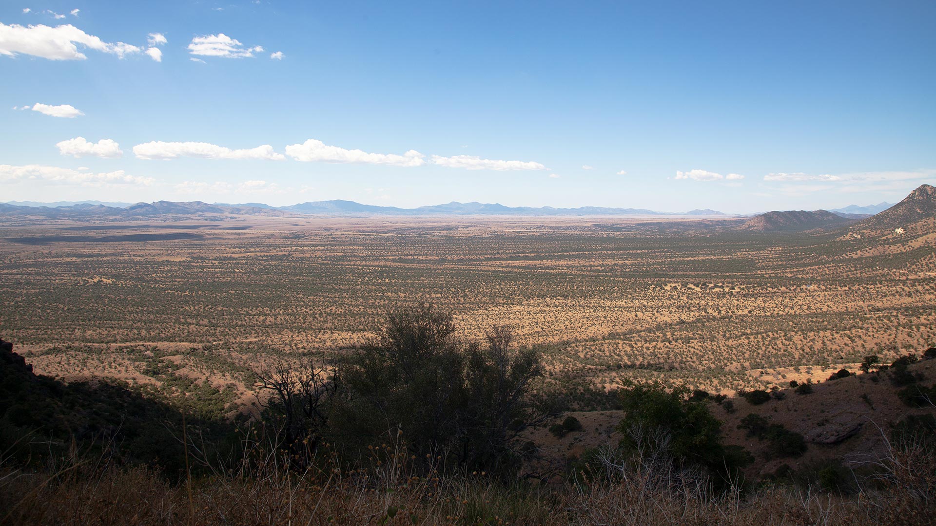 VIEW LARGER View of the San Raphael Valley from Montezuma Pass in Coronado National Memorial, on Wednesday, Oct. 18.
 SIA’s latest project calls for volunteers to survey approximately 160 miles of decommissioned forest service roads, aiming to curb the spread of invasive species, erosion and wildlife disturbance.
Bryon Lichtenhan, the stewardship specialist for SIA, stated that although the roads are administratively decommissioned, they’re still accessible to the public. He emphasized the area’s significance and said, “This is a really beautiful and important region for wildlife.”
The area is one of the last remaining open corridors for wildlife movement in between Sonora and Arizona and notably, it’s also jaguar territory.
In collaboration with the Forest Service and Borderlands Restoration Network, the SIA initiated a project to survey these road segments for future restoration.
Lichtenhan highlighted the need for volunteer efforts to enhance the valley and mountains, as part of a greater effort to improve the region.
Despite the absence of a border wall in this area, issues like erosion are becoming problematic, causing debris to get washed away with rain, filling up Mexican rancher’s stock tanks, nearby creeks and fragmenting the forest into smaller pockets. The excess water runoff is altering the landscape, hindering natural absorption by grasslands and trees.
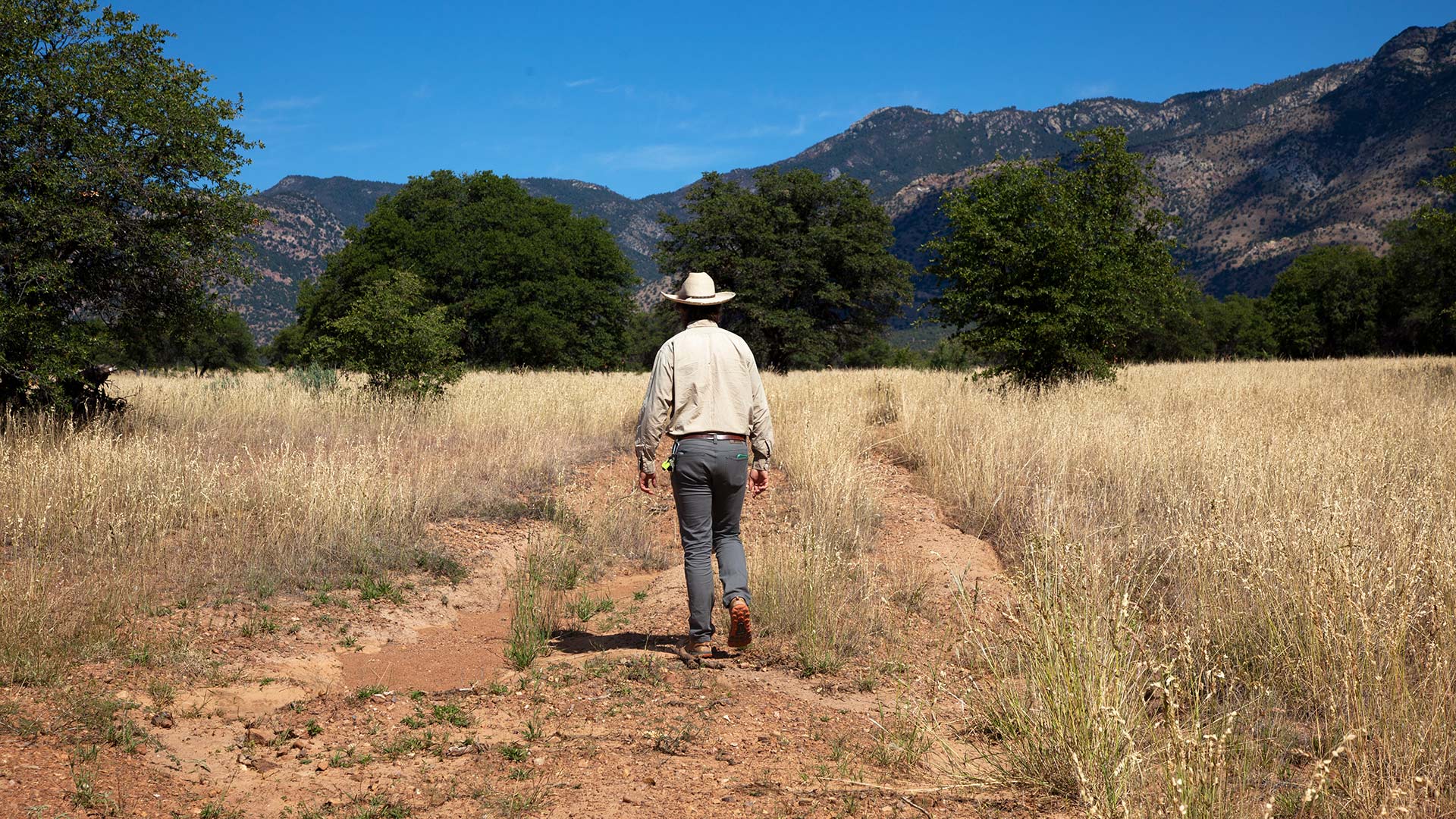 Bryon Lichtenhan, stewardship specialist for the Sky Island Alliance walking on administratively decommissioned roads in the Sierra Vista District of the Coronado National Forest on Wednesday, Oct. 18. Lichtenhan says erosion is becoming largely problematic in the area and can affect native plants from taking root.
Emily Burns, program director for SIA said closeby, there was once an oak grove in 2020, that was bulldozed for a parking lot for federal border wall construction. Although construction was canceled, scars were still left on the landscape.
“A road was cut in on the slopes of the Huachuca Mountains there, so that (the) border wall could come all the way over the Huachuca Mountains and extend in the San Rafael Valley,’ Burns said. “So if you’re driving here in 2020, this would have been a major construction site, there were steel bollards, sections of border wall pile, there were tanker trucks spraying water on the road, it was quite a scene.”
But the natural landscape has slowly started to heal.
“An interesting part of the history of attempts to modify the border when really it’s peaceful and there’s no construction, it is just fabulous habitat for wildlife,” Burns said.
Burns said about two-thirds of the state is walled off and in some places animals are no longer able to freely pass in between Sonora and Arizona, isolating species like ocelots and jaguars, who are cut off from the core population and unlikely to find a mate and reproduce.
The barrier has also disrupted seed disperses, affecting plant species’ ability to reproduce.
“We really consider the border wall a major evolutionary experiment that’s been set in motion and I think it’s up to all of us to try to prevent that experiment, leading to the extinction of species that are really iconic in North America and important to all of us,” Burns said.
 VIEW LARGER Emily Burns, program director for the Sky Island Alliance near border barriers in the Sierra Vista District of the Coronado National Forest on Wednesday, Oct. 18. Burns says the Sky Island Alliance has wildlife cameras that cover 30 miles of border which the organization monitors.
 The San Rafael Valley and Sky Islands for that matter, are known for their biodiversity. The region of mountain ranges span across four states and two countries, from Tucson, Arizona, all the way to Magdalena, Sonora.
Lichtenhan believes that wildlife populations will begin to contract away from the area.
“Part of why wildlife has been so numerous and healthy in these areas is because of the access to resources on both sides of the border,” Lichtenhan said. “Once you close those off, animals have to kind of pull back to where those major resources are available.”
SIA’s focus on rehabilitating old roads aims to provide wildlife with areas devoid of human impact or interaction with cars or ATVs.
“This project came from our desire to help this region recover, help make this an even more beneficial landscape for wildlife and that’s it,” Lichtenhan said.
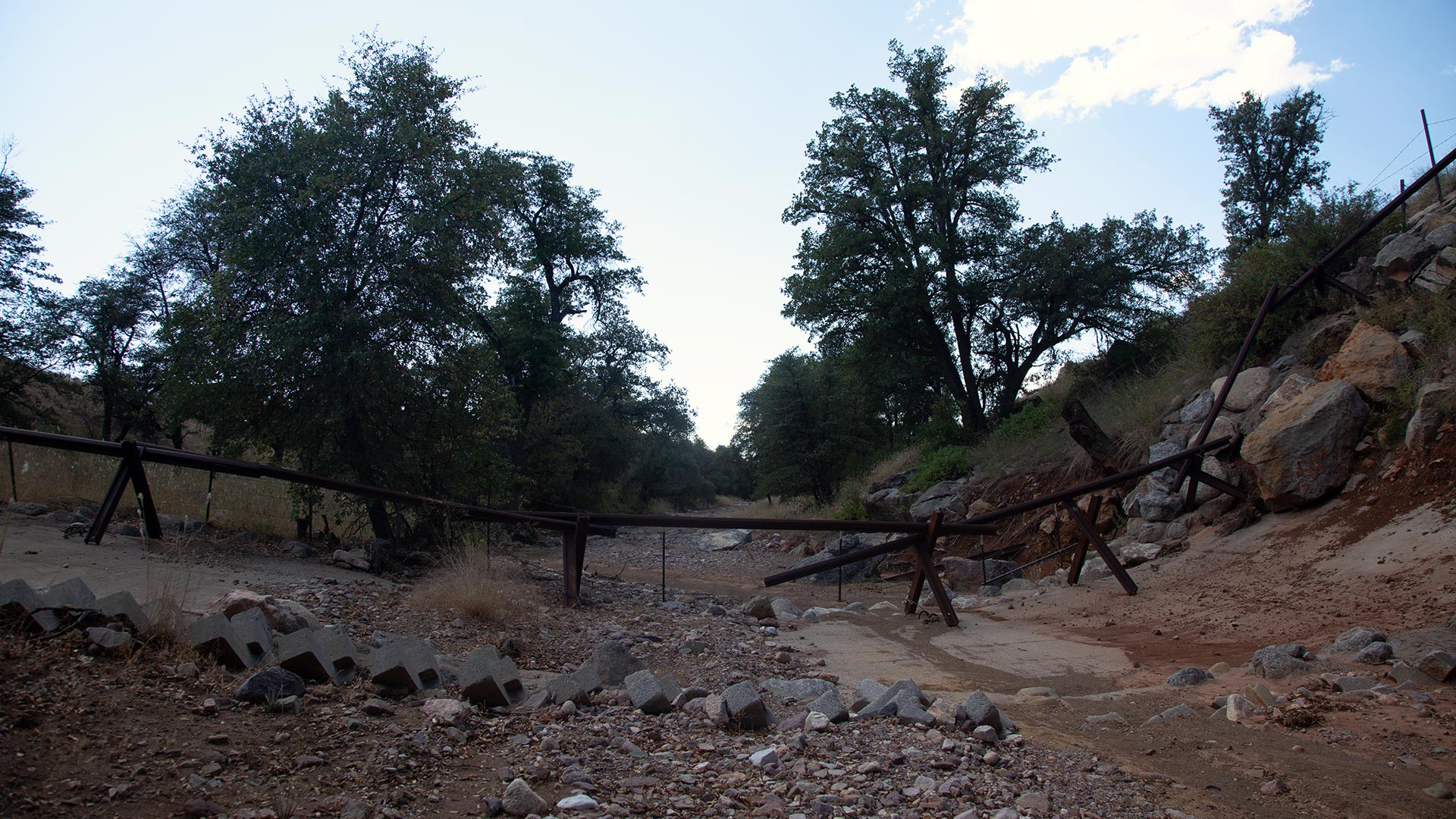 VIEW LARGER Border barriers in the Sierra Vista District of the Coronado National Forest on Wednesday, Oct. 18. Emily Burns, program director for the Sky Island Alliance says the state government opted not to place shipping containers in this specific area.
 With a network of wildlife cameras that cover 30 miles of border, SIA is able to document wildlife passageways. Burns hopes that the data will be able to convey more than just wildlife crossings.
“We want our wildlife community data to really tell the world that this is an incredibly important place where we do not need and cannot have a border wall in the future,” Burns said. “Right now, there are no current federal plans to build a border wall across the San Rafael Valley but there are law waivers in place and it could be that in the future, a presidential administration decides to build a border wall here.”
As volunteers work throughout the year to document road conditions, plans for restoration will be scheduled in the new year.
“Together we can really help to limit that erosive force in this area,” Lichtenhan said. “The sky’s the limit.”
By submitting your comments, you hereby give AZPM the right to post your comments and potentially use them in any other form of media operated by this institution.